Enernite Docs
Parcel Search
Parcel Search
Search for parcels based on criteria like proximity to selected grid infrastructure, minimum lot size, etc.
Perform a Parcel Search
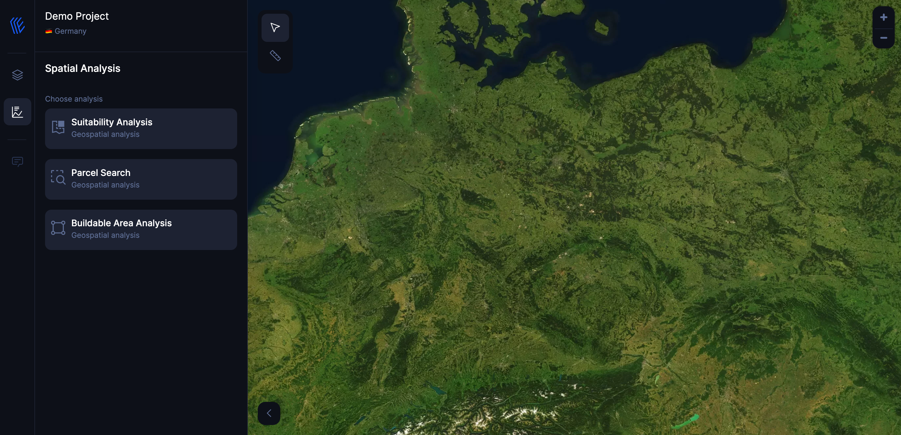
1. Open the Parcel Search module
Navigate to the Analysis tab in Enernite, then click Parcel Search.

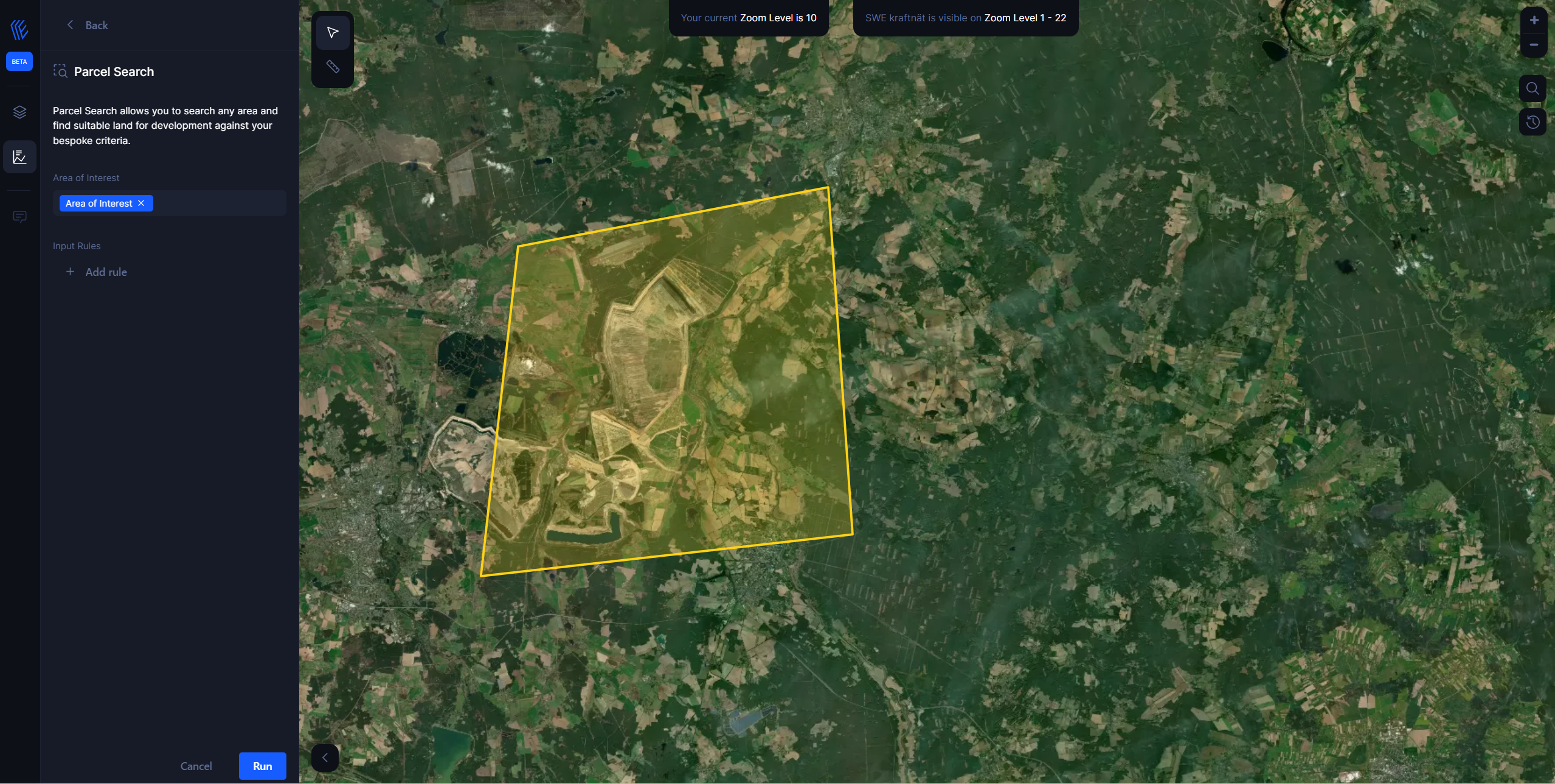
2. Draw an Area of Interest on your Map
Click on the Draw a shape button and draw an area of interest to perform the analysis within.

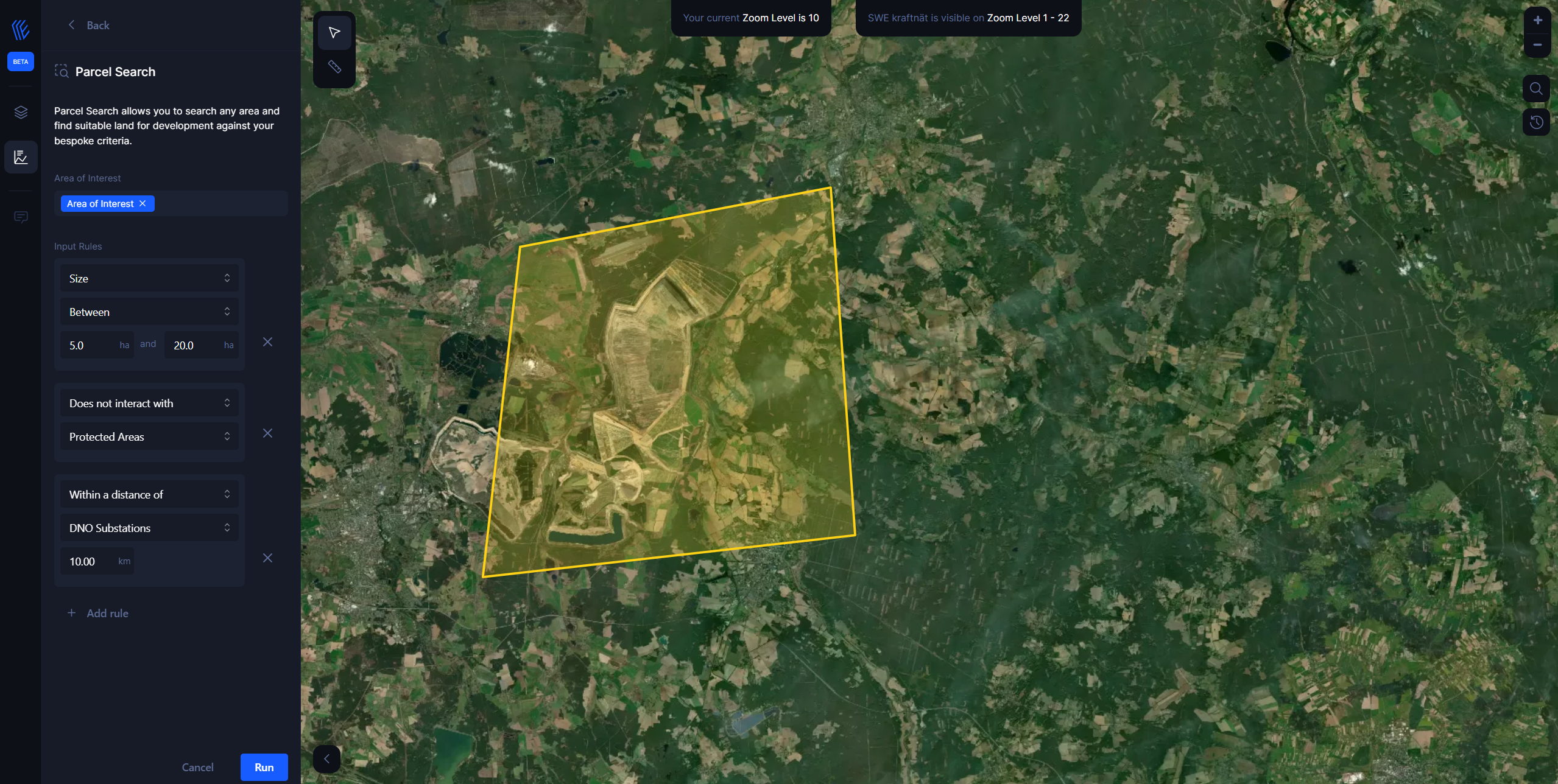
3. Add Input Variables
Add input variables that impact the parcel search.
In the example below:
- Size between 5 and 20 hectare.
- Does not intersect with Protected Areas.
- Within a distance of a substation of 10 km.

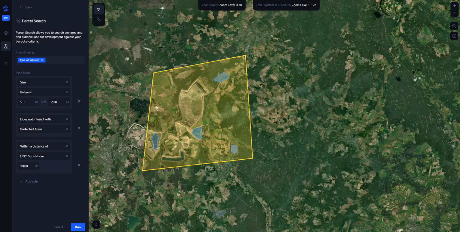
4. Results/Parcel Layer
Hitting the Run button on the parcel search pulls those parcels into the project as a data layer named Parcel Layer.
